Tussey Mountainback 50K Ultramarathon
Welcome to the Tussey Mountainback 50K Ultramarathon, a thrilling and picturesque journey through the heart of Rothrock State Forest.
This course offers a mix of challenging terrain and stunning natural beauty, perfect for ultrarunners seeking a memorable and rewarding experience. For the first 22 miles, the 50k follows the 50 Mile course, using the same aid stations. From mile 22 to mile 26.8, runners follow a new course. Along here, the course follows a former road that is no longer used. This portion may be best described as something between a gravel road and a very wide double track trail. At mile 26.8, runners will rejoin the 50 mile course and return to the start along the outbound legs. Finally, the first and last 0.75 miles of the road course are paved, near the ski slopes.
Stocked and staffed aid stations are available to all ultra participants at predetermined locations every three to four miles along the course. Terrain includes uphill, level and downhill grades, with shaded and open segments and some overlook vistas.
The course takes in Whipple Dam State Park and the Bear Meadows Natural Area. Total Elevation gain: 3,200 ft.
Course Overview

Course Description
-
The race begins and ends at the Tussey Mountain Ski Area, providing a convenient and accessible location for runners and spectators. The start line sets the stage for an adventure through diverse and rugged landscapes.
-
Covering a total distance of 50 kilometers (31 miles), the course is designed to challenge your endurance while showcasing the scenic beauty of Central Pennsylvania.
-
Runners will navigate a mix of gravel roads and rolling hills. The varied terrain demands agility and strength, making it an exciting and dynamic race.
-
The course features a total elevation gain of approximately 3,200 feet, with several significant climbs and descents. The elevation changes offer both challenges and opportunities for strategic pacing.
-
Throughout the race, you'll pass through lush forests, along serene streams, and over panoramic ridges. The course highlights the natural splendor of Rothrock State Forest, providing a visually stunning backdrop for your ultramarathon journey.
-
Well-stocked aid stations are strategically placed approximately every 4-6 miles, ensuring you have access to hydration, nutrition, and medical support as needed. These stations are manned by enthusiastic volunteers ready to assist you.
-
Clear and frequent course markings guide you along the route, minimizing the risk of getting off course and helping you stay focused on your run.
-
Our race staff and volunteers are dedicated to your safety and support throughout the event. Emergency access points and contact numbers are provided to ensure prompt assistance if needed.
Course map

(Click map to enlarge)
map Overview
Route Outline: The map clearly shows the full 50K loop, starting and finishing at the Tussey Mountain Ski Area. The route takes you through a variety of terrains, including gravel roads and rolling hills.
Aid Stations: Aid stations are marked along the route, spaced approximately every 4-6 miles. These stations provide essential hydration, nutrition, and medical support to help you stay strong and healthy during the race. If the weather is unseasonably warm, there will be an additional fluids station at the intersection with Wampler Road between aid stations four and eleven.
Study the course map carefully to familiarize yourself with the route, elevation changes, and aid station locations. This preparation will be invaluable as you tackle the challenging and beautiful Tussey Mountainback 50K Ultramarathon. Enjoy the journey through Central Pennsylvania's stunning landscapes!
leg 1
Start to Ridge Top: 3.2 miles
(Running Total 3.2)
Difficulty: Moderate
Topography:
Mostly gently climbing, with some steep ascents.

Leg 1 breaks from the Start Line on a slight downhill, on paved Bear Meadows Road. At bridge #1, the uphill begins. As you pass the stream along the right-hand side, you will traverse bridge #2, continue uphill and turn right onto Laurel Run Road (at 0.7 mi.), crossing bridge #3. At this point the road becomes packed gravel. Continue climbing to switchback #1. Switchback #2 occurs at 3.1 miles; only 0.2 miles to aid station one, at the crest of Laurel Run Road and the intersection of Mid-State Trail.
leg 2
Mid-State Trail to Pine Swamp Road:
4.0 miles
(Running Total 7.2)
Difficulty: easy
Beginning at the crest of the hill, Leg 2 rolls downhill past the Fleet Foot Hunting Club (.45 mi.) and Laurel Run Camp (1.1 mi.), both on the right. At the bottom of the hill (1.2 mi.) you will pass Bear Gap Road on the left. Pass Sand Spring Camp and a meandering brook on the right, and go through fern fields as you pass Wildcat Gap Trail. Continue past Bard Gun Club on the left (3.45 mi.) and several cabins to the right and left (3.8 mi.) before coming to the intersection of Laurel Run Road and Pine Swamp Road (on right) where you will find aid station two.

Topography:
Downhill to level; gravel.
leg 3
Pine Swamp Road to whipple dam:
(Running Total 10.7)
Difficulty: easy
3.8 miles
Topography:
Continue along Laurel Run Rd, straight to the aid station at Whipple Dam. This leg is a gentle descent without mild rolling in the later portions. There is one small rise just before the aid station. Enjoy the calm run but be mindful of any traffic. This is one of the only stretches that could see significant (but still little) traffic. The aid station will be at the entrance to Whipple Dam park. DO NOT GO INTO THE PARK. The 50 milers and relay runners will be entering, the 50k runners DO NOT GO IN.

Gentle downhill the whole way.
leg 4
Whipple Dam to Gettis Ridge Rd:
5.6 miles
(Running Total 16.3)
Difficulty: Moderate to hard
Topography:

Mostly up with some flatter spots.
DO NOT FOLLOW THE 50 MILE RUNNERS TO THE BEACH ROAD. This aid station is the first point at which the 50 km course differs from the 50 mile course. Your aid station is on Laurel Run Rd. Leave the aid station and continue along bearing left and up the hill with all the runners. This section has a lot of rolling in the beginning and end, with a big climb in the middle. Take it easy and you'll get through it.
leg 5
5.9 miles
Gettis Ridge Rd to North Meadows Rd:
(Running Total 22.2)
Difficulty: moderate to hard
Topography:

Descents and climbs.
This leg is from aid station 4 to aid station 11. It starts with a descent of almost 300 feet in 2.2 miles along Beidleheimer Road. You will be on mostly shaded gravel, and pass vistas on the right. You will pass by the Gettis Ridge Camp on the right, meeting up with Bear Meadows Road coming from the left at 2.2 miles. This is where you will separate from those running 50 miles and begin your own adventure. Turn left on Bear Meadows Road and begin the 2.2 mile climb to the summit, staying on the well travelled road. You will earn 900 feet of elevation experience in the process. From the summit, you will descend about 200 feet in less than a mile and continue to aid station 11. Passing Treaster Kettle Road on your right, you may encounter 50 mile runners for the short distance to the aid station.
Aid Station 11: You will again split from the 50 mile runners at this point. Parking is both on the right and the left as you approach the aid station. Do not block the yellow gate. This aid station is shared with the 50-mile runners. Any 50k runner support crew should return to the finish line from here.
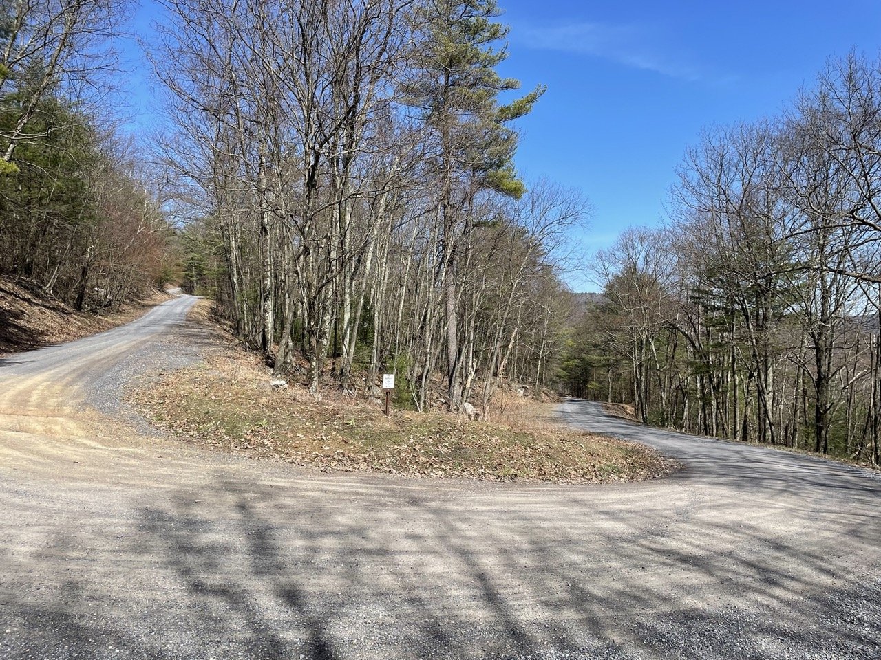
The climb up Bear Meadows Road (left and
right) at the intersection with Wampler
Rd. to rear.

The new location of aid station 11 at North Meadows Road (gated to the left) and Bear
Meadows (from rear and continuing). Parking is
about 25 meters to the rear.
leg 6
North Meadows rd to Bear gap rd:

(Running Total 25.2)
3.0 miles
Difficulty: moderate
Topography:
Steady climb.
Leg six begins at the North Meadows aid station. Enter the gate to North Meadows Road and continue until it meets Gettis Ridge Road at the top. Turn to the right and continue through the pines through the gate onto Bear Gap Road. The aid station is at the gate. Note that North Meadows Road is closed to all traffic. It is almost a ten mile drive between the ends of the road, but only a three mile run.
Aid Station 50k: Welcome to the only aid station dedicated to the 50k runners. Have a mini celebration for almost having completed a marathon.
leg 7
bear gap rd to mid-state trail:
2.7 miles
(Running Total 27.9)
Difficulty: moderate
Topography:

Steep descent and a climb.
Leaving aid station 50k, continue along Bear Gap Road. You might enjoy the steep descent, or your quads might complain a wee bit. In any event, turn right at the bottom and join Laurel Run Road. Your sense of deja vú is justified, you have been here before, just running in the opposite direction. From this point on, you will be running the reverse of your race. Fear not, you are nearly at aid station one. You need only climb the 1.1 mile and 200 feet to get there.
Aid Station 1 (redux): Well, you have been here before, only now your legs are beat. Enjoy a breather for a moment before you begin the descent to the finish line. This station offers very little parking, and support crew should avoid it. Be sure to thank the crew at the aid station, they have been there since 6 a.m.
leg 8
mid-state trail to finish: 3.2 miles
(Running Total 31.1)
Difficulty: moderate
Topography:

Steep descent and a climb.
This is your last leg. From the top of the hill at the aid station, simply follow Laurel Run Road downhill on the well trodden track. At the bridge turn left onto paved Bear Meadows Road and tell the 50 mile runners how easy they had it. Follow the road back to the finish line. As you approach the ski slopes, you will turn hard left through the fence to the finish line.